
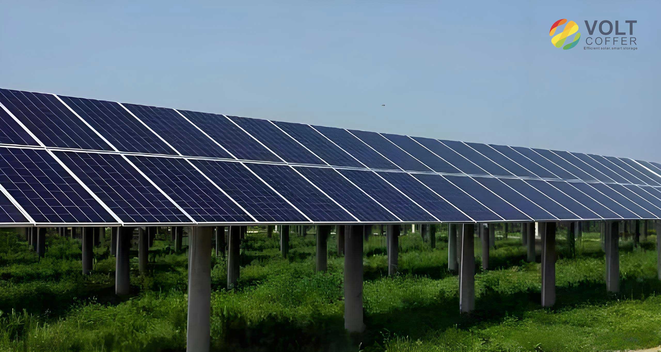
The rapid expansion of the photovoltaic industry has elevated the installation, inspection, and maintenance of solar panels to a critical operational priority. Traditionally, the auditing of solar panels within vast arrays relied heavily on manual methods, often involving personnel counting panels from photographs taken by drones or during on-site visits. This approach is not only labor-intensive and time-consuming but also prone to human error, leading to inaccuracies in inventory and potential oversight of defects. In this context, the urgent challenge lies in significantly enhancing the efficiency and accuracy of solar panel identification and inspection. Leveraging the inherent flexibility and coverage capability of Unmanned Aerial Vehicles (UAVs) coupled with sophisticated image recognition technology presents a transformative solution. This integration promises to minimize human intervention, automate tedious tasks, and deliver a highly efficient, reliable, and data-driven framework for managing photovoltaic (PV) installations.
The advent of UAVs has revolutionized inspection paradigms across various industries, and the energy sector is a prime beneficiary. Deploying drones for inspecting solar farms offers unparalleled advantages. They can swiftly cover extensive areas of solar panel arrays, accessing difficult or hazardous terrain with ease. UAV-based inspection drastically reduces manpower requirements, consequently lowering labor costs and mitigating safety risks associated with manual高空作业. Furthermore, drones act as powerful data acquisition platforms, gathering vast amounts of high-resolution imagery. This data serves as the foundation for long-term asset management, performance trend analysis, predictive maintenance, and overall optimization of the solar power plant, providing scientific insights that were previously difficult or costly to obtain.
The core of this intelligent monitoring capability lies in Image Recognition technology, also known as Computer Vision. This field focuses on enabling computers to analyze, interpret, and understand visual information from the world. By utilizing Artificial Intelligence (AI), specifically Deep Learning algorithms, systems can be trained to automatically identify, classify, and localize objects, patterns, and scenes within images. Convolutional Neural Networks (CNNs) form the backbone of modern image recognition, allowing for end-to-end learning from vast datasets. This technological maturity directly addresses the shortcomings of manual solar panel counting, eliminating human subjectivity and fatigue to deliver consistent, high-performance recognition.
This article details the design and implementation of an integrated UAV-based monitoring system specifically engineered for the automated identification and analysis of solar panels. The system is built upon a robust technical stack, combining mobile application development, backend services, and a custom-trained visual recognition model. The following sections elaborate on the overall system architecture, the functional design of its components, and the specific deep learning methodology employed for reliably detecting solar panels in aerial imagery.
Overall System Architecture
The proposed system is architected to achieve efficient, safe, and intelligent monitoring and management of solar panel arrays. It integrates advanced hardware and software components into a cohesive workflow.
Hardware System
The hardware subsystem is centered on commercial, high-performance UAV platforms, such as those from DJI, renowned for their flight stability, positioning accuracy, and reliable remote control. The drone, equipped with a high-resolution camera, executes autonomous or manual flight missions to capture aerial imagery of the solar farm. The remote controller facilitates real-time piloting and video downlink. Captured images and telemetry data are transmitted securely via wireless networks to the backend processing server for analysis.
Software System & Architectural Design
The software ecosystem adopts a “frontend-backend separation” design pattern to ensure maintainability, scalability, and a clear separation of concerns. This decoupled architecture allows each part to specialize in its function, enhancing overall system robustness and development agility.
Frontend (Client): Developed as a native Android application, the frontend leverages the Android SDK and the DJI Mobile SDK. Native development provides superior performance, direct access to device hardware, and a responsive user interface (UI). The app serves as the primary user interface for drone control, real-time video monitoring, mission triggering, and visualization of inspection results.
Backend (Server): The backend is built as a monolithic service using the Django web framework, chosen for its “batteries-included” philosophy, security features, and rapid development capabilities. It exposes a set of unified RESTful APIs following OpenAPI specifications, ensuring clear contract definitions for frontend-backend communication. The backend is responsible for critical tasks including user authentication, request handling, image processing, executing the solar panel recognition model, managing results in a database, and serving data for client requests. All data transmissions are encrypted to guarantee security and prevent information leakage.
Database: MySQL is employed as the relational database management system due to its proven performance, strong security model, and excellent compatibility. It reliably stores all structured data, including user information, flight logs, captured image metadata, and the results of solar panel recognition analyses, enabling fast querying and data management.
Service Proxy (Nginx): The Nginx web server is deployed as a reverse proxy and load balancer in front of the Django application server. This setup efficiently handles incoming client requests, distributes load across multiple backend instances if needed, manages SSL/TLS termination, and serves static files, thereby improving the system’s overall throughput, security, and reliability.
The following table summarizes the key components and their technologies:
| System Layer | Component | Technology / Tool | Primary Function |
|---|---|---|---|
| Hardware | UAV & Payload | DJI Platform with Camera | Aerial image capture, flight execution |
| Remote Controller | DJI Remote Controller | Drone piloting, command transmission | |
| Software | Mobile Client (Frontend) | Native Android, DJI SDK | User interaction, real-time video, control interface |
| Application Server (Backend) | Django (Python) | Business logic, API endpoints, model inference | |
| Database | MySQL | Persistent data storage | |
| Web Server / Proxy | Nginx | Request routing, load balancing, SSL | |
| AI/ML Core | Recognition Model | Custom YOLOv8 (PyTorch) | Solar panel detection and localization in images |
Functional Design and Development
Client Application Design
The mobile client is designed for intuitive operation in field conditions. Its main interface comprises several key elements. A split navigation menu is overlaid on the primary full-screen video feed from the drone’s camera. The left side of this menu displays real-time status information: battery levels for the drone and remote controller, signal strengths (remote control and GPS), and flight restriction status. The right side of the navigation menu houses functional buttons, most notably for accessing historical inspection records. A prominent capture/trigger button is positioned vertically centered on the right edge of the screen for easy thumb access.
Core client functionalities include:
1. UAV Connection and Control: Upon launch, the application automatically initializes and scans for connected DJI devices. Once a drone and remote controller are linked, the interface switches to the first-person view (FPV) from the drone’s camera, and the status panel populates with live telemetry data, allowing the user to monitor the flight and prepare for inspection.
2. Image Capture and Recognition Trigger: Pressing the capture button snaps a still image from the live video stream. A preview modal immediately displays the captured photo. The user is presented with two primary options: “Upload Immediately” (with a short auto-upload countdown for hands-free operation) or “Edit & Upload.” Selecting edit stops the countdown and opens an image cropping tool, allowing the user to precisely frame the area containing the solar panels of interest. Both automatic and manual uploads send the same data package to the backend, which includes the image file, timestamp, GPS coordinates (latitude, longitude), altitude, and estimated location. After the backend processes the image, the result is asynchronously pushed back to the client. A non-intrusive notification window appears in the corner of the UI, summarizing the detection count. Tapping this window reveals a detailed results page, while ignoring it causes the notification to auto-dismiss after a brief period.
3. History and Data Management: Tapping the history button in the navigation menu slides open a drawer from the right, presenting a chronological list of past recognition records. Each entry is selectable to view its complete detail page, showing all associated metadata and the annotated image. Users can delete records (implemented as logical soft-deletes) and, crucially, apply multi-criteria filters (by time, date, geographic area, panel count) to the history list. Filtered results can be exported in versatile formats: as an Excel spreadsheet containing aggregate statistics or as a zip package of the annotated images. Users can also customize image watermarks in the export, overlaying information such as capture time, GPS location, detection bounding boxes, and panel count onto the images themselves.
Backend Service Design
The Django backend is structured around three main functional modules to handle the workflow from image reception to data delivery.
1. Image Recognition and Annotation Module: This is the core processing engine. Upon receiving an image and its metadata from the client via a secure API endpoint, the backend first validates the data for integrity and security. The validated image is then fed into a pre-trained, customized solar panel detection model (detailed in the next section). The model processes the image, identifies and localizes all visible solar panels, and returns the count and the coordinates of bounding boxes around each panel. The backend generates a new image annotated with these bounding boxes. Both the numerical results (count, location data) and the paths to the original/annotated images are stored in the MySQL database. Finally, a structured response containing the recognition results is sent back to the requesting client.
2. Recognition Result Management Module: This module provides comprehensive data access interfaces. It handles queries from the client’s history panel. A list-view API allows filtering records based on multiple dimensions like time range, geographic bounds, or specific attributes, returning a paginated list of concise record summaries. A detail-view API retrieves and returns all stored information for a specific record using its unique identifier. Record deletion is implemented as a logical delete (a status flag is changed), preserving data for potential recovery and audit trails, with a separate cleanup process periodically performing physical deletion of old, logically-deleted records.
3. Data Statistics and Export Module: This module powers the advanced export functionality from the client. It accepts complex filter criteria identical to those used in the history view. It queries the database, compiles the matching records, and processes them according to the user’s export preference. For Excel export, it aggregates data (e.g., total solar panels counted across all filtered images, list of locations) into spreadsheet formats. For image pack export, it retrieves the corresponding annotated images, can apply requested watermarking, and packages them into a compressed zip file. The processed export is then made available for the client to download.
The interplay of these modules ensures a seamless pipeline for managing solar panel inspection data, as summarized below:
| Backend Module | Key Responsibilities | APIs / Outputs |
|---|---|---|
| Recognition & Annotation | Validate input, run AI model, annotate images, store results. | POST /api/recognize; Returns detection count and annotation data. |
| Result Management | Query, retrieve, and logically manage historical records. | GET /api/records (list), GET /api/records/{id} (detail), DELETE /api/records/{id}. |
| Data Statistics & Export | Filter data, generate aggregated reports, create image packages. | POST /api/export; Returns Excel file or ZIP archive download link. |
The Solar Panel Recognition Methodology
The accuracy of the entire system hinges on the performance of the visual recognition model. The approach is based on fine-tuning and enhancing a state-of-the-art object detection algorithm, YOLO (You Only Look Once), version 8, to specialize in identifying solar panels under various environmental conditions.
Data Collection and Preprocessing
A robust model requires a diverse and representative dataset. We collected a large corpus of aerial images featuring solar panels. The dataset encompassed variations in:
- Time & Illumination: Different times of day (morning, noon, afternoon) and varying weather conditions (sunny, overcast).
- Viewing Angles: Images taken from different altitudes and oblique angles.
- Panel Conditions: Clean, dusty, partially shaded, or damaged solar panels.
- Background Clutter: Arrays in different landscapes (desert, grassland, rooftop).
Each image was meticulously annotated using labeling tools like LabelImg or CVAT, drawing bounding boxes around every distinct solar panel module. The annotated dataset was then randomly split into three subsets: 80% for training, 10% for validation (to tune hyperparameters), and 10% for final testing (to evaluate the model’s generalization to unseen data).
Model Architecture: Enhanced YOLOv8
While standard YOLOv8 offers excellent speed and accuracy, we integrated attention mechanisms to boost its focus on the specific features of solar panels, which often exhibit strong periodical patterns and specific textures. We incorporated a combination of Spatial Attention and Channel Attention (Squeeze-and-Excitation) modules into the backbone network.
Theory and Formulation:
Let the input feature map from a backbone layer be denoted as $X \in \mathbb{R}^{H \times W \times C}$, where $H$, $W$, and $C$ are height, width, and number of channels, respectively.
Spatial Attention Module (SAM): This module learns ‘where’ to emphasize or suppress in the spatial dimensions. A common implementation involves:
- Applying average pooling across the channel dimension to generate a spatial descriptor: $U_{sa} = \text{AvgPool}(X) \in \mathbb{R}^{H \times W \times 1}$.
- Processing $U_{sa}$ through a convolutional layer followed by a sigmoid activation $\sigma$ to generate a spatial attention map $A_s \in \mathbb{R}^{H \times W \times 1}$ with values between 0 and 1.
$$ A_s = \sigma(f_{conv}^{7×7}(U_{sa})) $$
Here, $f_{conv}^{7×7}$ denotes a convolution with a 7×7 kernel. - The original feature map is then recalibrated via element-wise multiplication:
$$ X_{sa} = X \odot \text{Broadcast}(A_s) $$
where $\odot$ is element-wise multiplication and $\text{Broadcast}(A_s)$ expands $A_s$ to $ \mathbb{R}^{H \times W \times C}$.
Squeeze-and-Excitation (SE) Block: This module learns ‘what’ channels are important. It operates on the spatially-refined feature map $X_{sa}$.
- Squeeze: Global spatial information is compressed using Global Average Pooling (GAP) to produce a channel-wise statistic vector $z \in \mathbb{R}^{C}$.
$$ z_c = \frac{1}{H \times W} \sum_{i=1}^{H} \sum_{j=1}^{W} X_{sa}^{(c)}(i, j) $$ - Excitation: Two fully connected (FC) layers with a non-linearity (ReLU and Sigmoid) learn a non-mutually-exclusive channel weight vector $s$.
$$ s = \sigma( \mathbf{W}_2 \delta( \mathbf{W}_1 z + \mathbf{b}_1 ) + \mathbf{b}_2 ) $$
where $\delta$ is the ReLU activation, $\mathbf{W}_1 \in \mathbb{R}^{\frac{C}{r} \times C}$, $\mathbf{W}_2 \in \mathbb{R}^{C \times \frac{C}{r}}$, $r$ is a reduction ratio, and $\sigma$ is the sigmoid function. - Scale: The original (or spatially attended) features are re-weighted by the channel activation $s$:
$$ X_{se} = X_{sa} \odot \text{Broadcast}(s) $$
By inserting blocks that sequentially apply Spatial and Channel Attention (or a combined variant), the model learns to focus on the relevant spatial regions containing solar panels and to emphasize the feature channels that best describe their defining characteristics. This is particularly beneficial for distinguishing solar panels from similar-looking objects like skylights or certain roof textures.
Model Training and Evaluation
The training process commenced with weights pre-trained on the large-scale COCO dataset, leveraging transfer learning. The model was then fine-tuned on our custom solar panel dataset. The training configuration involved setting appropriate hyperparameters: batch size, initial learning rate, optimizer (typically AdamW or SGD with momentum), and number of epochs. The validation set was used to monitor metrics like mean Average Precision (mAP) at different Intersection-over-Union (IoU) thresholds to prevent overfitting and select the best model checkpoint. The final model’s performance was quantitatively assessed on the held-out test set.
The following table contrasts the key characteristics of different object detectors considered for this task, justifying the choice of an enhanced YOLOv8:
| Model | Speed | Accuracy (Typical) | Architecture | Suitability for Solar Panels |
|---|---|---|---|---|
| Faster R-CNN | Slower | High | Two-stage (Region Proposal + Detection) | High accuracy but may be overkill for real-time drone streaming; slower. |
| SSD (Single Shot Detector) | Fast | Good | Single-stage, multi-scale feature maps | Good balance, but YOLO variants often outperform. |
| YOLOv5/v8 | Very Fast | Very High | Single-stage, anchor-free (v8) | Excellent speed/accuracy trade-off, ideal for near-real-time processing from drones. |
| Enhanced YOLOv8 (Our Choice) | Fast | Higher | YOLOv8 + Attention Mechanisms | Optimized for the specific texture and pattern of solar panels, maintaining speed. |
Conclusion
The integration of UAV technology with a tailored, AI-powered visual recognition system presents a paradigm shift in the operation and maintenance of photovoltaic power plants. The system designed and elaborated upon here effectively addresses the inefficiencies and inaccuracies inherent in manual solar panel inspection methods. By automating the tasks of counting, locating, and logging solar panels from aerial imagery, it drastically reduces labor dependency, enhances operational safety, and enables the rapid assessment of expansive arrays. The “frontend-backend separation” architecture ensures a scalable and maintainable software foundation, while the incorporation of attention mechanisms into the YOLOv8 model significantly improves detection reliability for solar panels across diverse real-world conditions. The ability to filter, manage, and export structured inspection data provides valuable insights for asset management and predictive maintenance strategies.
Looking forward, as Artificial Intelligence and Computer Vision technologies continue to evolve, systems like this will become even more capable. Future work may involve extending the model’s functionality to not only detect solar panels but also classify their condition—identifying defects such as cracks, hotspots (using thermal imagery), or significant soiling. The fusion of visual data with other sensor data (e.g., irradiance sensors) could enable comprehensive real-time performance analytics. This project stands as a concrete application of how modern AI and robotics can converge to solve practical, large-scale industrial challenges, paving the way for smarter and more sustainable energy infrastructure management.